Brown Hill
Brown Hill lies to the east of the A624, south of Glossop.
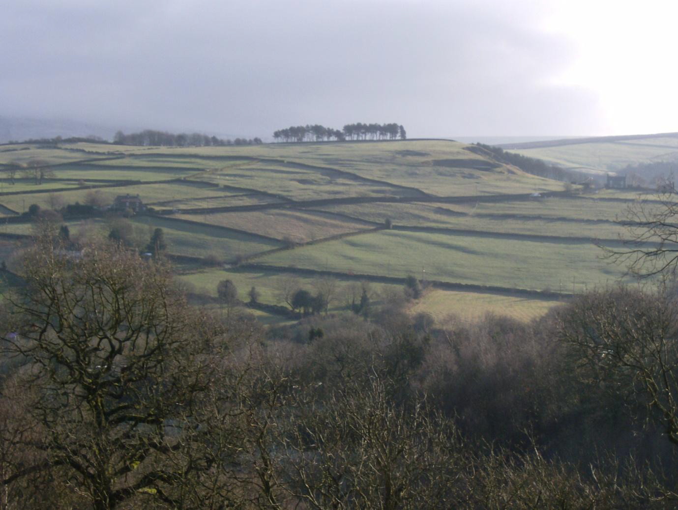
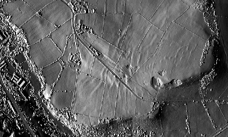
The late Dr Bill Hood took photos from an upper room at his house, Lees Hall, on a sunny March morning. He thought they showed a field system, and assumed it must be mediaeval. He showed these photos to the Glossop Historical Society in 2009.
.jpg)
Possible field boundaries (taken from lidar images below)...
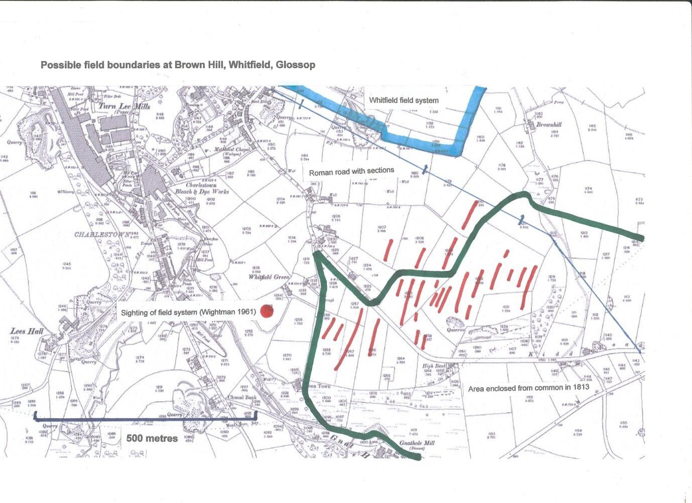
It seems likely that these are signs of a prehistoric (probable Iron Age/Romano-British) field system.
See also the report to the Derbyshire Historic Environment Record
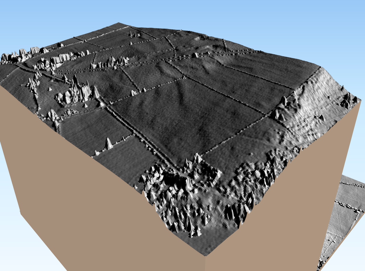
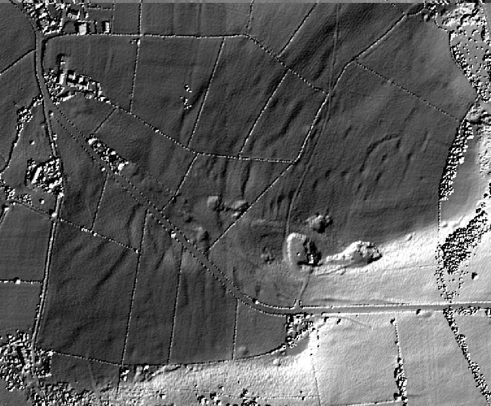
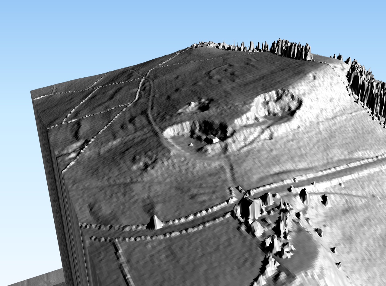
More work on lidar images has been done recently (April 2018) by Steve Whiteley. Steve says:
I re-rendered the lidar with a low angle light from the south east to try to pull out any features previously missed:
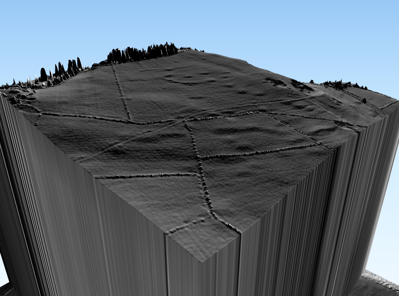
I also generated some obliques to see if they helped. There is a 1.5x vertical exaggeration and the spiky elements are trees! You should be able to orientate yourself from the quarry.
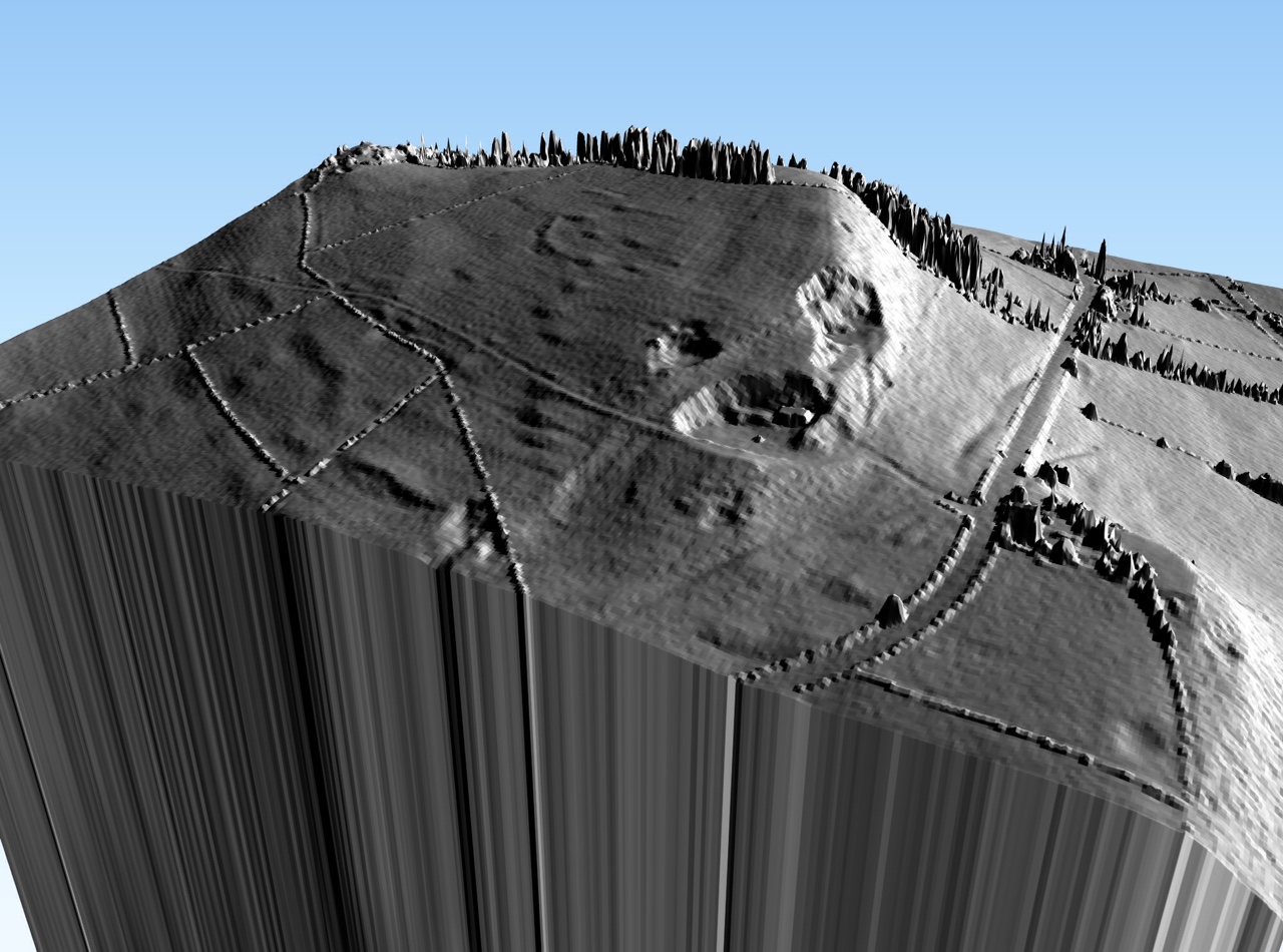
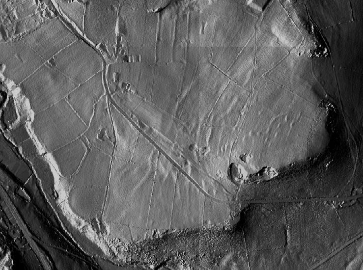
And part of the next tile to the west with the narrow lane past Whitfield Green in the foreground: