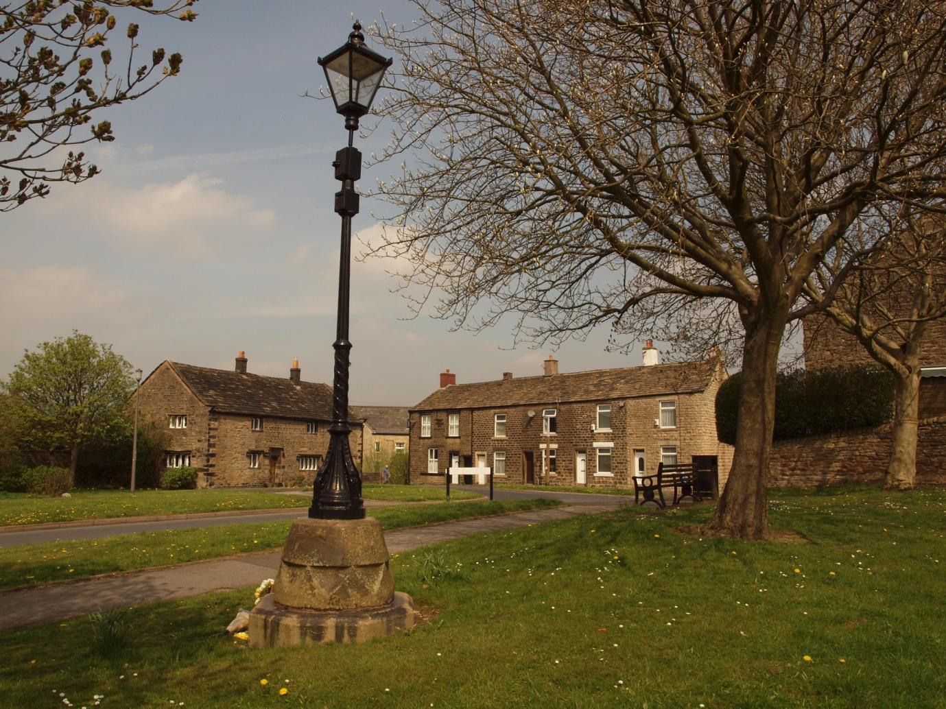
Hadfield Old Hall Square
The Old Hall (on the left in the picture below) has a 1646 datestone door lintel.
What's of interest is what we can be pretty certain is under the grass verges, which are Council-owned. This area was cleared in the 1960s, but we know from photos and maps that it was once crammed with cottages and at least one farm, some of which had C18th datestones but others of which may well have been earlier.
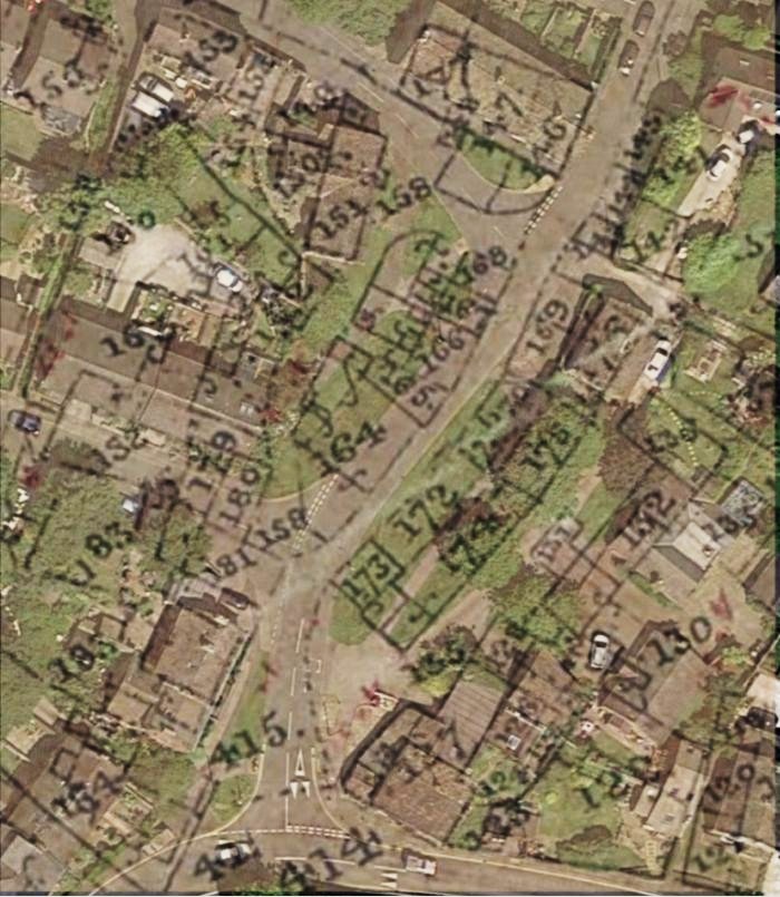
Old Hall Square, Hadfield as shown on the 1857 Poor Law map:
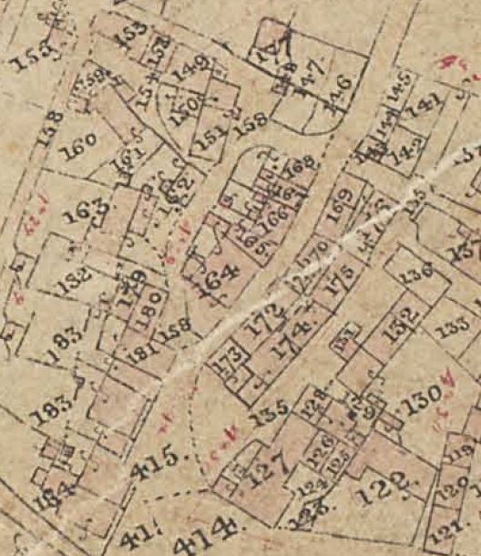
The above 1857 map has been overlaid on the modern Google Earth image (below) and this shows that, as the road is wider than the original, there would be only limited survival on the western side - about half of the big farmhouse (164) and the building behind it (165), possibly the corner of 180, then just the back walls and outbuildings of 166-8. On the eastern side, it looks as if 174 and 175 would probably be too close to the trees to be accessible, but 171-3 all appear to be under the verge on the west side of the footpath. This was an area packed solid with cottages back-to-back and so potentially very interesting.